Northern Catskills
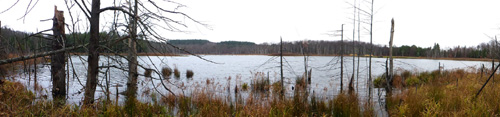
As the Long Path heads west and then north, the tall mountains of the Catskills are soon left behind; they become lower and lower until they are mere hills standing above the plain. Much of the trail now parallels the Schoharie Valley, an important route into the Catskills from points north. Early Dutch settlers made their homes here; there are many reminders of their past in the names of the places one passes. A major feature of the area is the reservoir complex maintained by the New York State Power Authority. In addition to hydroelectric power, the Schoharie Reservoir is a member of the great Catskill water reservoirs that supply distant New York City with clean drinking water.
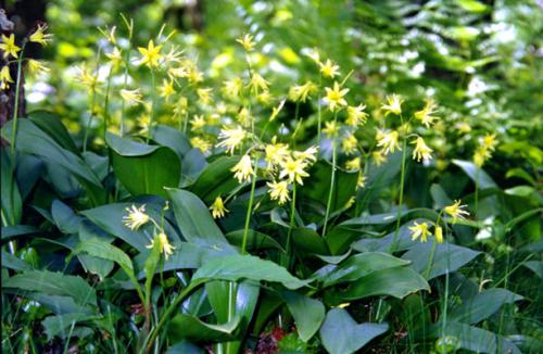
Wildflowers by the trailside. 2001 [ED WALSH]
27. Greene County Route 10 to South Mountain Road in Conesville, Schoharie County
Section 27: Greene County Route 10 to South Mountain Road in Conesville, Schoharie County
Quick Facts
Distance: 7.1 miles
Parks: Mount Pisgah State Forest, South Mountain State Forest, Ashland Pinnacle State Forest
Maps: Interactive Map, Catskill Trails (Long Path North)
Print-Friendly Version: Link
General Description
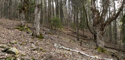
This lightly traveled section of the Long Path passes through the first of many state reforestation areas between the Catskills and the Mohawk River. As a consequence of reforestation there are large bramble patches, which can make hiking less pleasurable. Long pants are recommended, and the hiking experience is distinctly back country. The trail climbs steeply up Mt. Pisgah, follows the ridgetop over Richtmeyer Peak, and climbs a shoulder of Richmond Mountain. The trail continues on a logging road before descending to Bluebird Road through a Norway spruce plantation. On its way it passes through both mixed deciduous forests and plantations of red pine and Norway spruce. There are a few good views, both north towards the southern Adirondacks, and south towards the Blackhead Range and the Devil's Path. All of this section is marked with Long Path Aqua paint blazes. A side trail near the end of the section provides great ridge walking with many views through the trees when the leaves are down. This side trail traverses some of the highest peaks in the Catskills outside the "Blue Line," including Ashland Pinnacle and Huntersfield Mountain which has a lean-to.
Access
Take the New York State Thruway to Exit 21 (Catskill). Continue on NY Route 23 west approximately 20 miles to the Town of Windham. In Windham, turn right on Mitchell Hollow Road (Greene County Route 21) and go north about 5 miles to Greene County Route 10. Turn right on Route 10, which continues east for about a third of a mile and then curves left. Cunningham Road continues straight ahead here; stay on Route 10. About 1/4 miles past the curve, the Long Path begins just after a woods road goes off to the left.
Parking
0.00 Pullout off Greene County Route 10, about 200 feet south of the trailhead. (42.37532°, -74.23265°)
2.65 Parking area 0.4 mi from the Long Path. A woods road blazed with yellow DEC discs leads to the trail. Take Mt. Pisgah Road off Greene County Route 10, in 0.4 mi turn right onto a forest road, and follow this to the parking area at the end (1.35 mi). (42.37351°, -74.26306°)
4.60 Parking area off Bluebird Road (formerly CCC Road #2). (42.36873°, -74.28938°). This road is not maintained from December 1 to April 1.
5.70 Parking area just beyond the point where the Long Path reaches forest road. (42.36172°, -74.30128°).
7.10 Roadside parking on forest road off South Mountain Road. (42.37356°, -74.31530°)
Trail Description
0.00 From where the trail reached Greene County Route 10, proceed north past the parking area and turn left.
0.05 The Long Path proceeds uphill on a trail marked with aqua paint blazes and passes through a red pine plantation. It skirts the south side of an old quarry, then curves right along the west side of the quarry. The trail reaches an interesting rock wall and follows it to the right.
0.25 The trail makes a sharp switchback to the left and passes through a cleft in the cliff. It continues gradually uphill through the woods, crossing a few more low escarpments. The trail turns right onto an eroded woods road and continues uphill. There are lots of brambles.
0.55 The Long Path turns sharp left onto another woods road and begins climbing steeply.
0.65 The trail turns sharply to the right onto another woods road and continues uphill. Mt. Hayden can be seen from here when there are no leaves on the trees. Soon the trail turns right and leaves the road. It climbs steeply.
0.85 To the right are good views of the valley of the Manor Kill. The Long Path passes through some bramble patches and continues on a woods road for a short distance.
0.95 The woods road continues straight ahead, the trail turns left for the final ascent to the summit of Mt. Pisgah.
1.10 Reach the summit of Mt. Pisgah. This was formerly the site of a summit observatory. Remnants of the well that supplied water to the site may still be seen about 100 ft straight ahead, on the left side of the old carriage road that provided access from the valley. The summit was once cleared of vegetation, but today it is covered with a mature Norway spruce and red pine grove. There is a view to the north of the Helderbergs and the Adirondacks in the distance. At the summit, the Long Path turns right, soon crosses a stone wall, and descends through the forest. There is an interesting contrast here between the deep greens of the spruce and pine grove and the lighter greens of the deciduous forest to the right.
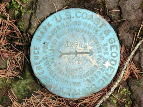
USCGS marker at the summit of Mt. Pisgah. 2012 [JAKOB FRANKE]
1.40 The trail leaves the evergreen grove, continues to descend to the left of a low escarpment, and reaches the col between Mt. Pisgah and Richtmyer Peak.
1.45 The trail veers right through the escarpment and begins a gradual ascent, skirting below private land to the north.
1.60 The Long Path crosses an old logging road, turns right, and ascends to the top of the ridge, then turns left to follow the ridge. After a level stretch, the trail continues to ascend to Richtmyer Peak. This entire area is covered with brambles.
2.55 The Long Path reaches the flat summit of Richtmeyer Peak. To the left there is a seasonal view through the trees towards the Blackhead Range. The trail now turns right and makes a short descent to the col between Richtmeyer Peak and Richmond Mountain.
2.65 The trail reaches a logging road and the start of a trail (yellow DEC markers) that leaves to the left and leads in 0.4 miles to a parking area. The trail crosses the logging road and continues uphill to the east summit of Richmond Mountain.
2.90 To the left a short side trail leads to a view to the south, with the Blackhead Range, Kaaterskill High Peak and the Devil's Path visible.The Long Path continues along the ridge and descends to the col between the two peaks of Richmond Mountain. Here it levels and follows the north shoulder of the main peak, then begins a steep descent.
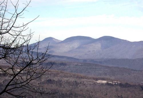
The Blackhead Range from Richmond Mountain. 2001 [HERB CHONG]
3.20 The trail reaches a wet area and turns left onto a logging road. In a tenth of a mile the road makes a jog, then goes straight, while the trail turns right. There are seasonal views to the north.
3.55 The Long Path reaches another logging road and turns left, following the road. In about a tenth of a mile an overgrown logging road heads down to the right. The trail continues straight on the road.
3.75 The trail reaches another woods road. Turn left.
3.95 The Long Path turns right into the woods, descending through a Norway spruce plantation, and crossing a few seasonal streams.
4.30 Near the large root mass of an uprooted pine tree the trail approaches a small ravine with a permanent stream on the left, and keeps descending along the stream.
4.45 Turn left onto Bluebird Road (gravel road) and follow it uphill.
4.60 The Long Path turns right into a parking area on the west (right) side of Bluebird Road. Sign in at the registration box at the north end of the parking area, proceed to the southern end of the parking area, turn right, and follow the Long Path blazes west. The trail can be wet in this area, then soon passes through a pine plantation.
4.80 Cross a small stream. The trail now slowly ascends through mixed forest, crosses a few stone walls, and passes by a couple of stone pillars on the right.
5.40 The trail turns sharply left, soon after passing DEP signs, and starts a steep ascent through forest consisting of mostly spruce and striped maple.
5.70 Reach a maintained forest road. (The old Long Path route to the left, to Ashland Pinnacle, the Huntersfield Mountain Shelter, and Albert Slater Road, has now been blazed with red DEC disks.) The Long Path turns right and follows the forest road downhill.
7.10 Reach South Mountain Road, the end of Section 27.
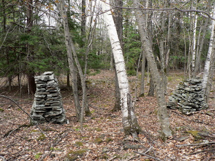
Stone pillars off the trail. 2010 [JAKOB FRANKE]
Previous Section: Section 26
Next Section: Section 28
28. South Mountain Road in Conesville, Schoharie County to West Conesville
Section 28: South Mountain Road in Conesville, Schoharie County to West Conesville
Quick Facts
Distance: 8.5 miles
Parks: NYC DEP Watershed land
Maps: Interactive Map
Print-Friendly Version: Link
General Description
This section of the Long Path is a mixture of pleasant woods walks and scenic road walks. The Long Path follows South Mountain Road, which has outstanding scenery, for about 3 miles. The trail then passes near Sicklers Mountain on private land, and reaches the ravine of the Manor Kill just before the section ends, providing great views of the Manor Kill and Manor Kill Falls.
Access
Take the New York State Thruway to Exit 21 (Catskill). Continue west on NY Route 23 for about 8 miles. Keep right on NY Route 145 and continue about 11 miles, then keep left onto Greene County Route 22. Continue straight onto Greene County Route 20 for about 4 miles. The road changes into Durham Road when it enters Schoharie County. In another 2 miles turn left onto Toles Hollow Road, then turn right onto South Mountain Road. In less than 2 miles the Long Path will come in from a forest road on the left, across from Cook Road on the right.
Parking
0.00 A few cars can be parked near the corner of South Mountain Road and the forest road. (42.37356°, -74.31530°)
3.80 There is parking in Conesville. (unlocated)
7.00 Pangman Road (formerly Pangburn Road) (limited parking). (42.36942°, -74.41737°)
8.50 NY Route 990V and Prattsville Road (Schoharie County Route 39). (42.38064°, -74.43084°)
Camping
Camping is available to backpackers in the reforestation areas near the start of this section. You may camp anywhere in the reforestation areas, as long as you stay 150 feet away from the trail and from water.
Trail Description
0.00 Turn left (west) on South Mountain Road. The next several miles will be roadwalking, but the scenery is outstanding.
3.05 Turn left on Potter Mountain Road (formerly Schoharie County Road 3).
3.80 Turn left onto Champlin Road in the hamlet of Conesville.
4.45 Turn right into the woods. For the next few miles the trail follows mostly old woods roads, and passes north of Sicklers Mountain. The trail is on private land here. Please respect the property, and sign the log book at the start of the trail.
The trail is closed from mile 4.45 to mile 7.15 during hunting season (October 1 to December 15), and you'll have to continue on Route 990V in the hamlet of Conesville.
Woods on the foot of Sicklers Mountain. 2010 [JAKOB FRANKE]
6.65 The Long Path turns sharply right on a woods road, then turns sharply left off the woods road.
6.85 The trail crosses hoses for the collection of maple sap, and an old barbed wire fence.
6.90 Turn sharply left onto an old overgrown woods road. To the right are views of the valley of the Manor Kill and the mountains north of it.
7.00 Turn left off the road. The trail goes slightly uphill, and follows to the right of a stone wall with barbed wire on top, and DEP signs.
7.15 The trail pases by a few old antennas and reaches Pangman Road, which is a gravel road. The Long Path turns left on Pangman Road, and in 100 ft turns right into the woods again.
7.35 An unmarked trail joins from the right.
7.65 There are views of the valley and mountains to the right. The trail follows an old chainlink and barbed wire fence on the right.
7.75 Turn right across the fence. There now is a barbed-wire fence on the left. The trail crosses a seasonal stream, turns left, then turns right, still following a barbed-wire fence. There are views to the right.
7.85 Turn left again, still following a barbed-wire fence.
8.05 The trail approaches a paved road, but turns right before it gets there, and continues over a small hill.
8.15 The ravine of the Manor Kill is to the right, the road to the left. The trail continues over another small hill.
8.25 Great viewpoint over the Manor Kill ravine and beyond.
8.35 The trail turns left and follows a woods road.
8.40 About 50 feet to the right is a good vantage point to admire the Manor Kill Falls.
8.50 The trail reaches Prattsville Road (Schoharie County Route 39), after turning left around a chain-link fence. To the right is the bridge across the Manor Kill, and the junction with Route 990V.
Manor Kill Falls. 2010 [JAKOB FRANKE]
Previous Section: Section 27
Next Section: Section 29
29. West Conesville to Doney Hollow
Section 29: West Conesville to Doney Hollow
Alerts
- Trail access through the former Nickerson Park Campground (now Nickerson Catskill Mountain Campground) is no longer available, so the description has been updated with a roadwalk route between the campground and Mine Kill State Park. This roadwalk route has shortened the overall length of this section by 2.25 miles (from 13.55 miles to 11.3 miles).
Quick Facts
Distance: 11.3 miles
Parks: Mine Kill State Park, Historic Lansing Manor
Maps: Interactive Map
Print-Friendly Version: Link
General Description
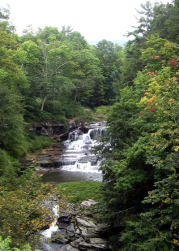
In this section, the Long Path leaves the rugged terrain of the Catskills and descends into the Schoharie Valley. After passing the Schoharie Reservoir, which is the northernmost outpost of the New York City water supply system, the Long Path begins a 30-mile journey along the Schoharie Valley and the hills surrounding Schoharie Creek. The trail passes through Mine Kill State Park, whose primary attraction is Mine Kill Falls. The Long Path passes both the top and the bottom of the falls, which plummet out of a spectacular gorge. Between the falls and the main part of the park, the trail follows a beautiful pine and hemlock forest. In the north end of the park are spectacular open views of the Schoharie Valley. Beyond Mine Kill State Park, the trail passes through the Lansing Manor Visitors Center of the Power Authority’s Blenheim-Gilboa pumped storage complex. There are expansive views up the Schoharie Valley from both Mine Kill State Park and Lansing Manor.
Access
Take the New York State Thruway to Exit 21 (Catskill). Continue west on NY Route 23 for about 30 miles to the Village of Prattsville. At the end of Prattsville, NY Route 23 crosses a steel bridge that goes over Schoharie Creek. Just before the bridge, turn right on Prattsville Road, and follow it for about 5 miles to the intersection of Prattsville Road and Route 990V.
Parking
0.00 Intersection of NY Route 990V and Prattsville Road. (42.38064°, -74.43084°)
5.95 Mine Kill State Park, at north end of swimming pool, when park is open. (42.43785°, -74.45867°)
6.70 Lansing Manor Visitors Center. (42.44886°, -74.46452°)
11.30 West Kill Road at Doney Hollow. (42.48519°, -74.48447°)
Camping
3.35 Campsites available at Nickerson Catskill Mountain Campground (fee charged).
Camping is allowed in the state reforestation areas 150 feet from the trail and water.
Trail Description
0.00 At the intersection of Prattsville Road and NY Route 990V, the Long Path turns left and follows NY Route 990V downhill toward Gilboa. On the left side of the trail is the Schoharie Reservoir.
0.90 Reach the Gilboa-Conesville Central School on the right side of the road. To the left is the former site of the Gilboa Settlement. From 1840 to 1869, a cotton mill, tannery, church and cemetery stood on the ground that is now covered by the Schoharie Reservoir.
1.00 After passing the school, bear right on Wyckoff Road.
1.15 Opposite the school playground, turn left into the woods.
1.25 Reach the NYC DEP watershed land property line. Follow the property line for a short distance and continue downhill through mixed woods.
1.55 Reach the intersection of Route 990V and Flat Creek Road, near the Gilboa Town Hall and Post Office. On the right, just past the town hall, is an exhibit of fossilized trees that were discovered while constructing the Schoharie Reservoir. The Long Path continues along NY Route 990V, which curves left and goes downhill.
1.80 The Long Path crosses Schoharie Creek on a bridge. There is a small cemetery to the right, just past the bridge.
2.00 Turn right onto Stryker Road. Pass the Gilboa Museum on the right (open only on summer weekends; check the website for more information).
2.50 Reach a "Road Closed" gate. On the left is a large farm and site of Rockland Cider Works. Walk around the gate to proceed along the road that is closed to vehicles for the next 0.75 mile, with views of Schoharie Creek to the right.
3.25 Reach the other "Road Closed" gate at the intersection of Cresent Road, and continue straight on Stryker Road.
3.35 Pass the entrance to Nickerson Catskill Mountain Campground and continue along Stryker Road.
4.35 Reach junction with NY Route 30 and turn right. To the right, Reed Hill is visible in the distance.
4.65 Reach the Mine Kill Falls Overlook parking lot. A short detour here provides access to a walkway that leads to an overlook of Mine Kill Falls. Continue straight on NY Route 30.
Mine Kill Falls. 2001 [MICHAEL WARREN]
4.80 Cross a bridge over the Mine Kill, with views of Mine Kill Falls below, and then immediately turn right off the road onto a footpath that enters the woods.
4.85 Turn left, with views of the Mine Kill to the right. The trail crosses a small stream.
5.05 A white-blazed trail comes in from the right.
5.15 Cross a stream on a bridge. To the left is a beautiful cascading waterfall. The trail climbs continuously from here to the park entrance road, passing several rock piles on the right part way up. Near the top, two trails lead right, but the Long Path continues straight ahead.
5.45 Emerge onto an open field and cross the main park entrance road. The Long Path continues along the western edge of an open field to reach the park administration building.
5.55 Reach the park administration building on the right, where there are restroom facilities. The trail bears left and follows a mowed path at the western edge of an open field with scattered evergreens. From this path, there is a spectacular view up and down the Schoharie Valley.
5.75 Turn right and descend along the northern boundary of a soccer field, then pass a small playground just north of the swimming pool.
5.95 Turn left and follow a cross-country ski and snowmobile trail that leads from Mine Kill State Park to Lansing Manor. Here, there is a spectacular view north along the Schoharie Valley and across the Blenheim-Gilboa Reservoir. Soon, a yellow-blazed cross-country ski trail leaves to the right, but the Long Path continues straight ahead. The trail soon leaves Mine Kill State Park and enters the New York State Power Authority Lansing-Manor Blenheim-Gilboa complex; the boundary is not marked.
6.30 Reach an open field with scattered cedar trees. Note the fences around small cedar trees. These trees are pruned so as to provide the deer with a source of browse, and the fences prevent the deer from killing the trees. There are also a number of bluebird feeders. Bue sure to watch for Long Path blazes on top of fence posts by the cedar trees.
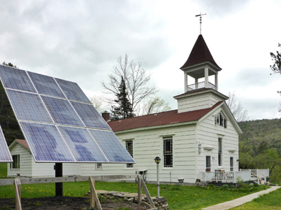
6.70 Reach a picnic area and cross the parking lot of the Lansing Manor Visitors Center. At the far end of the parking lot, the trail follows a walkway through the Visitors Center, where brochures on the historic Lansing Manor and the Blenheim–Gilboa pumped storage power plant are available. Brochures are also available at the nearby museum. There are picnic tables at the Visitor Center, making this an ideal lunch stop in the warm months.
Lansing Manor Visitors Center. 2001 [MICHAEL WARREN]
6.85 Take the left fork in the walkway and pass the entrance to the museum. The Long Path now heads across a field with trees, skirts a wooded area on the right, then turns right and cuts diagonally across another field to enter the woods in 0.25 mile.
Lansing Manor. 2001 [MICHAEL WARREN]
7.15 After a rather steep descent, reach the bottom of a ravine. The trail now ascends gradually and crosses a powerline right-of-way.
7.40 Reach the top of a hill, with a view down to the dam of the Blenheim-Gilboa Reservoir. During periods of low electrical demand, water is pumped up the hill to the reservoir. During periods of high demand, the water is released, thus generating electricity.
7.80 Turn left down a bank to cross a small stream, then turn right to reach the NY Power Authority's North Access Road. Turn left onto the road, and in about 100 feet turn right off the road onto a trail down the bank. Note that this trail into the woods down the steep bank may be difficult to spot.
7.95 Bear left just before reaching the Schoharie Creek. This section, which may be overgrown at times, has views of the creek throughout. During flood conditions, this section may be flooded and it will be necessary to instead walk the access road to NY Route 30.
8.35 Turn left up a ladder next to a measurement station to reach the Power Authority's North Access Road, then turn right to follow the road.
8.50 Reach NY Route 30, turn right to cross a bridge over West Kill, then immediately turn left onto Creamery Road. Soon, you will pass a cemetery on the right.
8.75 Turn right uphill into the woods at the very end of the cemetery, across from house #137 on the left. In about 0.1 mile, pass a stone wall. Soon, you'll reach a hedgerow and pass another stonewall on the right.
9.00 Reach a field and cut diagonally across the corner of the field to reach a hedgerow, and turn left.
9.10 Go down a short, steep bank to West Kill Road and turn left to follow the road.
9.30 Reach the intersection of West Kill Road (Schoharie County Route 43) and Burnt Hill Road. Continue left on West Kill Road.
9.50 Just past a driveway, turn left into the woods.
9.65 Cross West Kill Road to the north side of the road, making a short left-right jog. Note that from October 10-December 15, this section is closed to hiking; during this period, turn left onto West Kill Road and follow the road for about 0.8 mile, past the beaver pond on the right, and turn left into the woods 100 feet past a DEC boundary sign.
9.80 Turn left onto a woods road.
10.00 Turn left, leaving the woods road, and in 0.1 mile turn left again back onto the woods road.
10.45 Turn left and downhill, toward a beaver pond.
10.60 Reach the DEC State Reforestation Area boundary.
10.65 Cross West Kill Road to the south side of the road and descend to West Kill. The trail continues west along the creek.
11.05 Turn right away from the creek and climb back up to West Kill Road. Turn left onto the road and follow it for 0.15 mile, across Doney Hollow.
11.30 This section ends where the trail turns right into the woods to follow Doney Hollow. There is room to park several cars in this area.
Previous Section: Section 28
Next Section: Section 30
30. Doney Hollow to West Fulton
Section 30: Doney Hollow to West Fulton
Quick Facts
Distance: 8.6 miles
Parks: Burnt-Rossman Hills State Forest (Eminence State Forest)
Maps: Interactive Map
Print-Friendly Version: Link
General Description
In this section, the Long Path passes from Doney Hollow to the highlands of Eminence State Forest. While there are no great views in this section, the trail is full of glimpses of the area’s historic past. Along the way, the trail passes through sites of abandoned sawmills, gristmills and cemeteries, evidence that this area was once settled. In the early to mid-1800s, this area was home to some of the earliest settlements in the Schoharie region. During the depression in the 1930s, the State purchased many of the marginal farms in this area to establish state reforestation areas. The CCC built some primitive roads on this newly acquired state land. This section of the Long Path gradually ascends from Doney Hollow to the highlands of the Burnt Hill Reforestation Area. It then descends to Cole Hollow before again climbing to the level highlands of Rossman Hill. From there, the trail descends steeply to Sawyer Hollow and the Village of West Fulton. For part of the way, the Long Path follows the Schoharie Trail, which was constructed in the early 1980s by the SUNY Cobleskill Outing Club. In areas where the Schoharie Trail follows drivable roads, the Long Path follows newly constructed trail.
Access
Take the New York State Thruway to Exit 21 (Catskill). Continue on NY Route 23 west for 35 miles to Grand Gorge. In Grand Gorge, turn right, and follow NY Route 30 north for about 8 miles to North Blenheim. Turn left on West Kill Road, which is the second left after Route 30 crosses the West Kill, and follow West Kill Road for 2 miles to Doney Hollow.
Parking
0.00 At West Kill Road in Doney Hollow. (42.48519°, -74.48447°)
5.00 On Duck Pond Road by the brook. (42.53787°, -74.48214°)
6.40 DEC trailhead parking lot on Morey Road. (42.54862°, -74.49069°)
7.40 Sawyer Hollow Road where Long Path enters the road. (42.55906°, -74.48641°)
8.90 Village of West Fulton picnic area. (42.56438°, -74.46290°)
Camping
Camping is allowed in the state reforestation areas 150 feet from the trail and water.
5.85 Rossman Hill Lean-to.
Trail Description
0.00 The Long Path turns right off West Kill Road and follows an old road up Doney Hollow. This section of the Long Path, which is marked with Long Path aqua blazes, heads uphill on the left side of the stream and soon starts a large switchback to the left because the old road ahead has been washed out. [The original route followed the Schoharie Trail, constructed in the early 1980s by the Cobleskill Outing Club (COC). Its start is designated by a COC trail marker.]
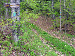
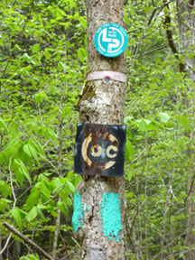
Doney Hollow. 2014 [JAKOB FRANKE]
0.40 The trail reaches the old road along the stream again.
0.55 The trail crosses Doney Hollow on a bridge and continues uphill on the right side of the stream. In about half a mile stone walls appear on the right.
1.05 To the left is a large man-made structure, constructed of local rock. This is the site of one of the two water-powered sawmills that operated along Doney Hollow in the mid 1800s. The rock structure was part of an impoundment of the stream. This section of the trail is on the Burnt Hill Reforestation Area of Eminence State Forest. Burnt Hill got its name from the many wildfires that spread through this area in the early 1900s, improving the huckleberry crop. One part of the area was known as Huckleberry Kingdom. Today, the area has become a mature forest, and the state periodically harvests the timber here. The trail continues on the old road, flanked on the right with stone walls.
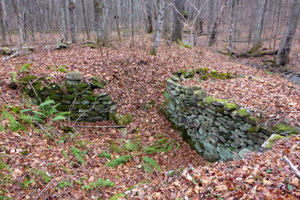
Remnants of saw mill in Doney Hollow. 2015 [JAKOB FRANKE]
1.45 A woods road comes in from the right. On the left is the site of a homestead. The Long Path continues straight ahead. The trail passes through a stand of red pines and begins to level off, passing through an area that is occasionally wet.
1.90 The old woods road ends at the gravel Burnt Hill Road. The Long Path crosses Burnt Hill Road and continues north through the woods.
2.15 An opening to the left leads to a large unnamed pond off Burnt Hill Road. Camping is allowed in the state reforestation areas 150 feet away from the trail or water. The trail continues ahead through the woods to the right of the pond, crossing a short bog bridge and a small bridge.
2.40 The trail reaches the crest of Burnt Hill, turns left, and begins a steep descent to Cole Hollow.
2.50 Turn right and begin to follow a snowmobile trail.
2.60 Turn left onto an old logging road, leaving the snowmobile trail. The logging road soon ends, and as the trail descends it follows a series of switchbacks, eventually turning left and descending on an old woods road to the bottom of Cole Hollow.
3.00 The trail reaches the stream and continues west, close to the stream.
3.30 Turn left on gravel Cole Hollow Road, and continue uphill on the road. To the right the gravel road crosses the stream on a bridge.
3.85 Just after crossing into the Town of Fulton, Cole Hollow Road turns left. The Long Path turns right and follows gravel Huckleberry Kingdom Road.
3.95 On the right is the site of an old homestead, at the corner of an open field.
4.20 The trail goes back into state land and soon crosses a small stream. Just after the stream crossing, the trail turns left off the road, and follows the stream uphill.
4.35 The trail passes a cellar hole on the left, and a number of stone walls on the right. This is said to be the site of the childhood home of Henry Conklin. Author of ‘Through Poverty’s Vale’, he wrote about the difficulty of eking out a living in these hills around 1840. This book, an interesting early history of the Schoharie Valley, is available at the Old Stone Fort in Schoharie. The Long Path parallels the stream while it continues uphill through a hemlock gorge.
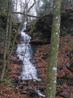
4.80 Turn left and cross the stream on a bridge, following a tributary uphill. Near the top of the hill, the trail turns right and leaves the stream. Here, to the left, there is a series of cascading waterfalls along the stream.
5.00 The Long Path turns left onto the first of a series of CCC-constructed roads. Just before Duck Pond Road crosses the stream, there is a small parking area. Near a concrete abutment along the stream, the trail turns right, makes a short, steep climb to pass a small old cemetery, and then descends to the left to cross the stream. With high water this may no be an easy crossing. The trail switchbacks to the left and then turns back to the right, following the stream for a short distance. The trail then leaves the stream and continues uphill.
5.20 Turn right and continue between two stone walls. In the next mile the trail passes lots of stone walls.
5.40 Cross Burnt Hill Road and continue west through the woods. There is room to park several cars here.
5.65 The trail crosses a stream on a new bridge and enters the flat area of Rossman Hill.
5.85 The Long Path passes the Rossman Hill Lean-to. Water is available from a well located 100 yards in front of the lean-to, which may be dry in summer. The trail passes through a hemlock stand, then enters a pine forest, and continues in a generally northwesterly direction.
6.25 The trail passes an area on the right that was clear cut in 2013-2014. Soon Rossman Hill Cemetery is visible to the right.
6.35 Reach Morey Road. Here, the trail bears left, crosses the road, and enters a parking area. One hundred feet to the right is the historic Rossman Hill Cemetery. Its large size is a good indication of how many people lived in these hills prior to reforestation. Past the cemetery on the right was the site of the Rossman Hill Methodist Church, which was abandoned in the 1930s. There is no evidence of the church today.
Looking Glass Pond. 2015 [JAKOB FRANKE]
6.45 The trail reaches the edge of Looking Glass Pond and turns right. The West Fulton Rod and Gun Club constructed this 20-acre pond. The trail intersects a yellow-blazed mountain bike trail that circles the pond. Across the pond are fishing piers. At the dam the Long Path turns right and follows the pond’s outlet stream downhill.
6.60 Cross Rossman Hill Road and continue to follow the stream downhill, passing a series of cascades.
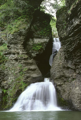
6.65 At the bottom of the cascades there is an old stone foundation, which was once the site of a gristmill. Please help protect what is remaining. The stonework is very fragile. The trail follows the stream steeply down to Sawyer Hollow, passing several waterfalls along the way.
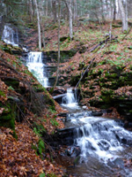
Falls in the Looking Glass Pond outlet stream. 2015 [JAKOB FRANKE]
7.05 Near the bottom of the hillside the trail crosses a stream on a wooden bridge, then heads east to another bridge over Panther Creek.
7.20 From the bridge, turn right and follow along the creek bed downstream to an old logging road that crosses an open field up to Sawyer Hollow Road. If traveling from the opposite direction, one reaches this point just uphill from a DEC fishermen’s parking sign.
7.40 Turn right (east) onto paved Sawyer Hollow Road (CR 20) and follow it into West Fulton. About 200 ft to the left is a small parking area. This road closely follows the route of an old Native American trail that was used during the Revolution by the British in October 1780. On the left the hiker passes the Peter Smith Church, built in 1831 by the founder of West Fulton. At one time it was featured in Ripley’s “Believe It or Not,” because its steeple and bell were located on the hill behind the church. Since then, the church was turned around and the steeple and bell were put in place. It is currently a private residence.
8.60 Reach the Village of West Fulton at an intersection with West Fulton Road. To the right on West Fulton Road and across the stream there is a picnic area on the left side of the road, with room to park several cars. To continue, proceed straight ahead on Patria Road.
West Fulton. 2014 [JAKOB FRANKE]
Previous Section: Section 29
Next Section: Section 31
31. West Fulton to Middleburgh
Section 31: West Fulton to Middleburgh
Alerts
- No current alerts.
Quick Facts
Distance: 11.8 miles
Parks: Patria State Forest, Vroman's Nose Unique Area
Maps: Interactive Map
Print-Friendly Version: Link
General Description
Leaving West Fulton, the Long Path regains the highlands west of Schoharie Creek. The trail continues through pleasant reforestation areas and passes through stands of mature pine and spruce, with occasional evidence of the early settlement in this area. After descending steeply to cross Pleasant Valley, the Long Path climbs over the top of a hill, and then descends to Hardscrabble Road near NY Route 30, with dramatic views of the Schoharie Valley. The Long Path follows NY Route 30 north through Vroomansland, the flat floodplain of Schoharie Creek. The trail ascends Vroman’s Nose on the steep red trail. A sentinel over the Schoharie Valley, Vroman’s Nose is one of the most spectacular natural features in New York. The Long Path descends off Vroman’s Nose to the north on the blue trail, crosses Vroomansland, and follows the edge of Schoharie Creek to the Village of Middleburgh.
Access
Take the New York State Thruway to Exit 21 in Catskill. Continue west on NY Route 23 about 8 miles to NY Route 145, then west on Route 145 about 30 miles to the Village of Middleburgh. In Middleburgh, take NY Route 30 south about 8 miles to West Fulton Road (Schoharie County Route 4). Then turn right on West Fulton Road and follow it for 3 miles to West Fulton.
Parking
0.00 West Fulton town picnic area. (42.56438°, -74.46290°)
2.00 On Patria Road. (42.56661°, -74.45144°)
3.00 On Mallon Road. (42.58499°, -74.43881°)
5.60 Small parking area. Directions: drive north on Patria Road to the intersection with Greenbush Hill Road, turn right and in about 0.7 miles there is an intersection with Snow Ridge Drive. At this point Greenbush Hill Road turns to the left and Snow Ridge Drive continues straight ahead. There are signs on both roads saying private roads. Continue on Snow Ridge Drive, which is still a public Right-of-Way (ROW). In another 0.5 miles there is a road to the right. This a DEC maintained road providing access to a portion of Patria State Forest. This intersection is at 42.60635°, -74.41105°. There is a sign at this intersection that says private land, but this does not pertain to the road. Start up the DEC road and in about 0.1 mile you will enter the Patria State Forest and in about another 0.25 miles there is a small parking lot on the left. The parking lot is at 42.60172°, -74.41352°. There is a lightly used trail off the back of the parking lot, blazed with red paint, that comes to the LP at 42.60145°, -74.41262°.
10.45 Church Street and the blue trailhead on Vroman’s Nose. (42.59335°, -74.35041°)
11.80 Village of Middleburgh (town park; elementary school). (Unlocated)
Camping
Camping is allowed in the state reforestation areas 150 feet away from the trail and water.
Trail Description
0.00 The Long Path leaves West Fulton on Patria Road. Continue uphill on Patria Road, continue along the road as it makes a sharp left.
0.80 Just past a sharp bend to the right there is a house and a barn on the right, the Long Path turns left into a field, and heads uphill.
0.90 Enter Patria State Forest. Head uphill, steeply at times.
1.25 Turn right onto a woods road. The woods road is sometimes used a snowmobile trail. In one hundred feet turn left uphill leaving the woods road. The trail continues uphill, with a break in the slope to the left.
1.70 The trail levels off, turns right, and crosses the ridge. After the ridge, turn left and descend on an old woods road toward Patria Road.
2.00 Cross Patria Road and descend through the woods to a stream. The trail turns left and heads uphill along the stream in a deep hemlock forest.
2.40 Turn right, cross the stream, and continue through a plantation of spruce and pine. After a short level stretch, the trail turns left and climbs steeply up the ridge. When the grade levels off, the trail turns right and crosses the ridge, following the edge of the reforestation area. At the east end of the ridge, the trail turns left and follows the east side of the ridge.
3.00 Cross Mallon Road and re-enter the reforestation area. There is a small parking lot here. The trail follows a woods road, crosses under a power line, and then turns right, leaving the road. The trail turns left and begins a gradual descent toward Pleasant Valley.
3.40 Cross a seasonal stream and parallel a rock wall, and an old property boundary, skirting private land.
3.85 The trail switchbacks to the right as it continues downhill on a moderate grade.
4.00 Turn left and descend steeply.
4.15 After crossing Pleasant Valley Stream on a bridge, the trail turns right onto the old Pleasant Valley Road for a short distance. The trail then turns left onto an old woods road.
4.40 Cross the stream on a bridge and ascend moderately, leaving the stream, and continue to follow the woods road through a pleasant hemlock forest.
5.20 The Long Path turns right to follow another woods road. As the trail reaches the crest of the hill, a woods road comes in from the right. The Long Path continues ahead over the crest of the hill.
5.40 Turn right, leave the woods road and snowmobile trail, and continue through a mixed hardwood forest and spruce plantation.
5.60 Turn right, and begin to descend through the woods, parallel to a rock wall. If you turn left instead of right there is a small parking area in about 200 ft.
6.00 Turn right and follow the abandoned Hardscrabble Road, continuing to descend. On the left is a reliable spring. In a few hundred feet, another abandoned road, now a snowmobile trail, comes in from the left near the site of an abandoned farm. The Long Path continues downhill along Hardscrabble Road.
6.05 The Long Path turns left off abandoned Hardscrabble Road and rejoins the snowmobile trail as it heads downhill.
6.10 The trail crosses a stream and continues to follow the snowmobile trail downhill along a rock wall. As the trail leaves State land, the snowmobile markers change from the round DEC discs to orange diamond-shaped markers.
6.70 Cross under a power line, then turn left uphill away from the stream onto a logging road.
6.90 The trail leaves the logging road on the right and turns downhill.
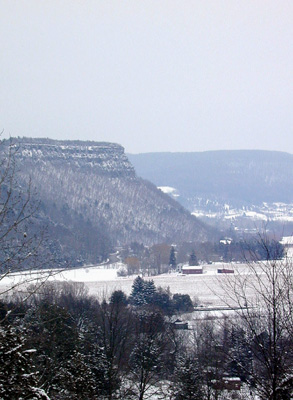
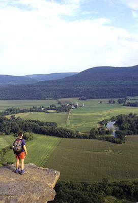
Vroman’s Nose. 2001 [HERB CHONG] View from Vroman’s Nose. 2001 [MICHAEL WARREN]
7.50 Enter an open field. The trail continues across the field with views of the Schoharie Valley and Vroman's Nose.
7.65 Reach Hardscrabble Road. Across the road is a large gray barn. Turn left on the road.
7.70 Reach NY Route 30 near highway marker 30/9502/1179. Turn left on Route 30 and follow it north.
9.20 Just before a NY Route 30 sign on the right near highway marker 30/9502/1195 on the left, the Long Path turns left and follows a red-blazed trail up Vroman’s Nose on a very steep grade. As there is loose dirt and scree here, it is suggested that you have very sturdy boots and carry a walking stick or ski pole for balance.
9.40 Reach the top of the extreme grade, having gained 400 vertical feet in the last 0.2 miles. At this point the trail turns right and continues to climb the ridge at a more moderate grade. As the trail begins to level off, views of the Schoharie Valley open up through the trees.
9.50 The red trail ends at an intersection with the green trail. The Long Path turns right and follows the green trail up to the summit of Vroman’s Nose. There is a view to the right, across the Schoharie Valley to the Catskills. To the left of the view is a campsite.
9.65 Reach the summit of Vroman's Nose at a large, flat area of bedrock known as The Dance Floor, with a spectacular view across the Schoharie Valley and Vroomansland south to the Catskills. This is a wonderful place to have lunch, rest and take in the sun. Locals have been taking the hike up here for over a hundred years, as is evidenced by the initials in the rock. In 2017, the Vroman’s Nose Preservation Corp donated this mountain to NYS DEC, and it is preserved as a Unique Area. Although the route followed by the Long Path up the mountain is quite steep, the summit can also be reached by an easy 600-foot climb from the maintained parking lot at the base of the green trail on West Middleburgh Road. A very informative book on the history of Vroman’s Nose and its environs, written by Dr. Vincent Schaefer, the founder of the Long Path, is available at the Old Stone Fort in Schoharie. The Long Path continues along the green trail, following the cliffs, with spectacular views along the edge of the escarpment.
*9.65 Note that as of 2023, the 0.2 mile section of the Long Path/Green Trail from 9.65 to 9.85 is temporarily closed from February 1 through July 31 to protect nesting peregrine falcons. A parallel route away from the cliff edge, marked with red foot trail markers, can be used during this time period.
9.90 Reach an overhanging promontory, with views both up and down the Schoharie Valley. You can see north to the Village of Middleburgh and the cliffs of Middleburgh, where the Long Path continues north and east toward Albany County. Here the green trail ends and the Long Path continues on the blue trail that descends, sometimes steeply, through the woods.
10.15 The yellow trail, which leads to a parking area on Mill Valley Road, begins to the left. The Long Path turns right and continues to follow the blue trail downhill on an old road.
10.45 The blue trail ends at Church Street, just past a church and a house. The Long Path turns right on Church Street and follows it to Route 30.
10.65 Turn left on NY Route 30 and follow Route 30 for about a mile.
11.70 Cross the Schoharie Creek on the Route 30 bridge.
11.80 Reach the intersection of NY Routes 145 and 30 in the Village of Middleburgh. To continue on the Long Path, follow Route 145 east.