Penns Hill Trail Loop
Directions to trailhead
Take the Garden State Parkway to Exit 69, turn left at the bottom of the ramp onto County Route 532 West, and proceed for 2.2 miles to the park entrance, on the left. Follow the entrance drive past the maintenance garage to the large parking lot.
Hike Description
Some important notes:
- The park requires hikers sign in and out at the trail register located at the kiosk to the left of the outdoor restroom building. (This restroom building is closed during the winter.) The box containing the trail register is a little tricky - bend down and look up underneath for the latch to open the vertical door that swings down.
- Ticks are abundant in this area in the summer and it is not unheard of to pick one up in the winter as well.
- Exercise extreme caution on the many boardwalks and foot bridges - they can be VERY slippery when wet or icy.
- Although hunting is not permitted in this park, there are certain days when hiking trails are closed due to hunting on neighboring properties. In 2011 these dates were Dec 5-10 and Dec 14. Call 609-971-3085 if you want to check before heading out.
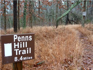 From the parking lot proceed to the kiosk to the left of the outdoor restroom building and sign in at the trail register. Continue up the walkway to the Visitor’s Center and walk around either side to the front of the building and Wells Mills Lake. Veer slightly right towards the “Penns Hill Trail” sign, the start of the white-blazed trail.
The white-blazed trail winds along Wells Mills Lake through a very pleasant fairytale-like cedar forest where you might expect to find a gnome peeking around a tree. Several planks, boardwalks and footbridges lead across swampy areas.
As the trail exits the cedar forest and veers away from Wells Mill Lake, you will be surprised to find how hilly the otherwise pancake flat Pine Barrens can be. You will go up and down several hills reaching the summit of Penns Hill (126’) marked by a bench, 2.5 miles into the hike.
 At the 3.6-mile mark, step over a fence and immediately turn right as the white-blazed trail joins the yellow and green trails on a wide sand road. In one tenths of a mile the three combined trails will make a sharp turn to the left at the boundary of the Joseph A. Citta Scout Reservation. Pay close attention to staying on the trail through this area as it traverses private property. It won’t be difficult as the trails are very well blazed and signs clearly indicate the proper direction.
After a short distance cross Oyster Creek on a bridge then watch for the white-blazed trail to leave the woods road to the left as the yellow and green trails continue ahead between two park signs.
The yellow and green-blazed trails cross over once again at the 6-mile mark. The white-blazed trail once again merges back with the yellow and green-blazed trails at 8.2 miles just before crossing a wide bridge over Oyster Creek. A short distance ahead Wells Mills Lake comes into view on the left and straight ahead, the Visitor Center at the end of the hike.
Turn-by-Turn Description
[ 0.00] Start white-blazed Penns Hill Trail other side of Visitor's Center
[ 0.30] Straight on white over foot bridge when blue goes right
[ 0.40] Keep straight on white when yellow/green crossed over
[ 0.45] Cross unmarked sand road
[ 1.15] Cross unmarked trail
[ 1.85] Two mile marker
[ 2.00] Cross unmarked sand road
[ 2.50] Summit of Penns Hill at bench
[ 2.80] Laurel Hill
[ 3.50] White joins green and yellow to the right on sand road other side of fence
[ 3.60] White/yellow/green turns sharply left at scout reservation
[ 3.80] Cross Oyster Creek on bridge
[ 3.85] Trails veer left when woods road comes in from right
[ 4.00] White leaves as foot path to left when green/yellow continue on sand road between park signs
[ 4.70] Five mile marker
[ 6.00] Cross over yellow/green
[ 6.40] Cross woods road
[ 6.70] Seven mile marker
[ 7.60] Cross woods road
[ 8.20] White turn right on woods road joining green/yellow
[ 8.30] Cross wide bridge over Oyster Creek
[ 8.35] Keep straight on white/yellow/green as pink Cold Brook Trail goes right; Wells Mill Lake on left
[ 8.40] Visitor Center